
Faculty Research Connections Profile
Education
B.S. National Cheng Kung University, Taiwan, 1991
M.S. National Cheng Kung University, Taiwan, 1993
M.Arch. University of Washington, 2001
Ph.D. University of Washington, 2008
Areas of Interest
My research is focused on establishing an integrated platform that can consist of a software-hardware tools suite and a curricular module for introducing geographic information science (GISci) and its associated geospatial technologies to urban design students. I envision that this platform can facilitate the adoption of the Science of Where and the efficient deployment of modern geospatial technologies for urban design practice and research.
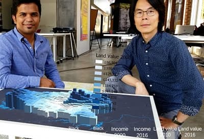
For me, the key task has been to assemble a toolkit with a common visual language that combines mapping and geographic analytics to connect location-based data to what planners and designers do routinely. I have identified four recent major trends in geospatial technologies: 1) increase in dimensions with 3D GIS; 2) integration with remote sensing; 3) cloud-based GIS; and 4) integration with immersive visualization technologies, including Virtual Reality and Augment Realty. I have also devoted my time and efforts in the recent years to developing a cohesive view towards the goal of establishing a GIS tools suite for urban design teaching and applied research.
My recent class projects and research findings have been published in a number of journals or news articles:
Scenario Planning with GIS: A Tale of Two Cities: https://www.youtube.com/watch?v=lsui2PqoGuI
Geodesigning Coastal Cities: The Case of Wilmington, NC https://www.youtube.com/watch?v=0Yx0ro9BzeU
Geodesign scenarios: https://www.sciencedirect.com/science/article/pii/S0169204616302468
(Geo)Design Coastal Cities: Design with Data (and Nature too)
http://www.theplanjournal.com/article/geodesign-coastal-cities-design-data-and-nature-too
Grad Students Re-envision Neighborhood’s Future Using 3D GIS https://www.esri.com/about/newsroom/arcnews/grad-students-reenvision-neighborhoods-future-using-3d-gis/
As a tool for public engagement, GIS has its roots in participatory approaches to planning and design, bringing mapping practices to local communities in order to promote public discloses, knowledge production, and problem solving for shared challenges. I have been particularly interested in data visualizations using 2D mapping and 3D modeling. Over the past year, I have focused my research on Augmented Reality (AR) with the belief that AR offers an interactive method to expand both non-computerized and computerized visualization techniques in planning and design. My work in AR has brought attention from many local organizations and generated interests for future collaborations, including Knight Foundation, Levine Museum of the New South, Charlotte-Mecklenburg Library, and OpenStreets704. I have recently been selected as one of the five Knight Foundation-Niantic Labs AR Fellows. With the support of this fellowship, I have organized a special event in which we incorporated the popular Pokémon-GO game into an OpenStreets704 event in order to encourage more public participation to this type of community event.
Knight Foundation-Niantic Labs AR Fellows Program: https://nianticlabs.com/blog/knightfellowsaug2018/
Urban Design Professor Named Niantic/Knight Fellow: https://inside.uncc.edu/news-features/2018-09-04/urban-design-professor-named-nianticknight-fellow
OpenStreets704 Fall 2018 Pokémon-GO game: http://openstreets704.com/open-streets-704-teams-up-again-with-niantic-and-pokemon-go/2018/
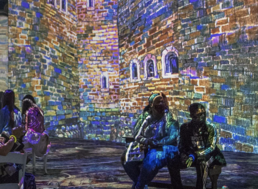
My most recent research aims to enhance the current practice of public participation in urban planning and community design by using extended reality (XR) to create an immersive, intuitive, and interactive digital user interface for accessing socio-economic data and 3D visualizations of future urban forms needed to promote informed public engagement and better decision-making. XR is an umbrella term encompassing augmented (AR), virtual (VR), and mixed reality (MX) technologies.
In 2020, I received two grants from Knight Foundation to support my continuing effort on exploring the potential of XR in urban planning/design and story-telling. I was named one of seven recipients of $1 million in funding from Knight Foundation to foster civic engagement through access to public data. Funded as part of Knight Foundation’s Smart Cities initiative, my project, “Transforming City of Charlotte with Immersive Visual Data,” will develop an immersive platform that provides 3D visualizations of future developments in Charlotte neighborhoods and community data to engage community members in the creation of the City of Charlotte’s comprehensive plan. Another Knight Foundation grant continues to support my collaborative project with the Levine Museum of the New South to develop a web-XR platform for an on-going exhibit focused on story-telling of Charlotte’s history.
Immersive Visualization Project Wins Knight Foundation Grant https://coaa.uncc.edu/news/2020-06-11/immersive-visualization-project-wins-knight-foundation-grant
Knight Foundation funds seven civic data projects https://statescoop.com/knight-foundation-funds-seven-civic-data-projects/
Investments in digital engagement and smart city initiatives foster a more equitable Charlotte https://knightfoundation.org/press/releases/investments-in-digital-engagement-and-smart-city-initiatives-foster-a-more-equitable-charlotte/
Explore HIS recent work
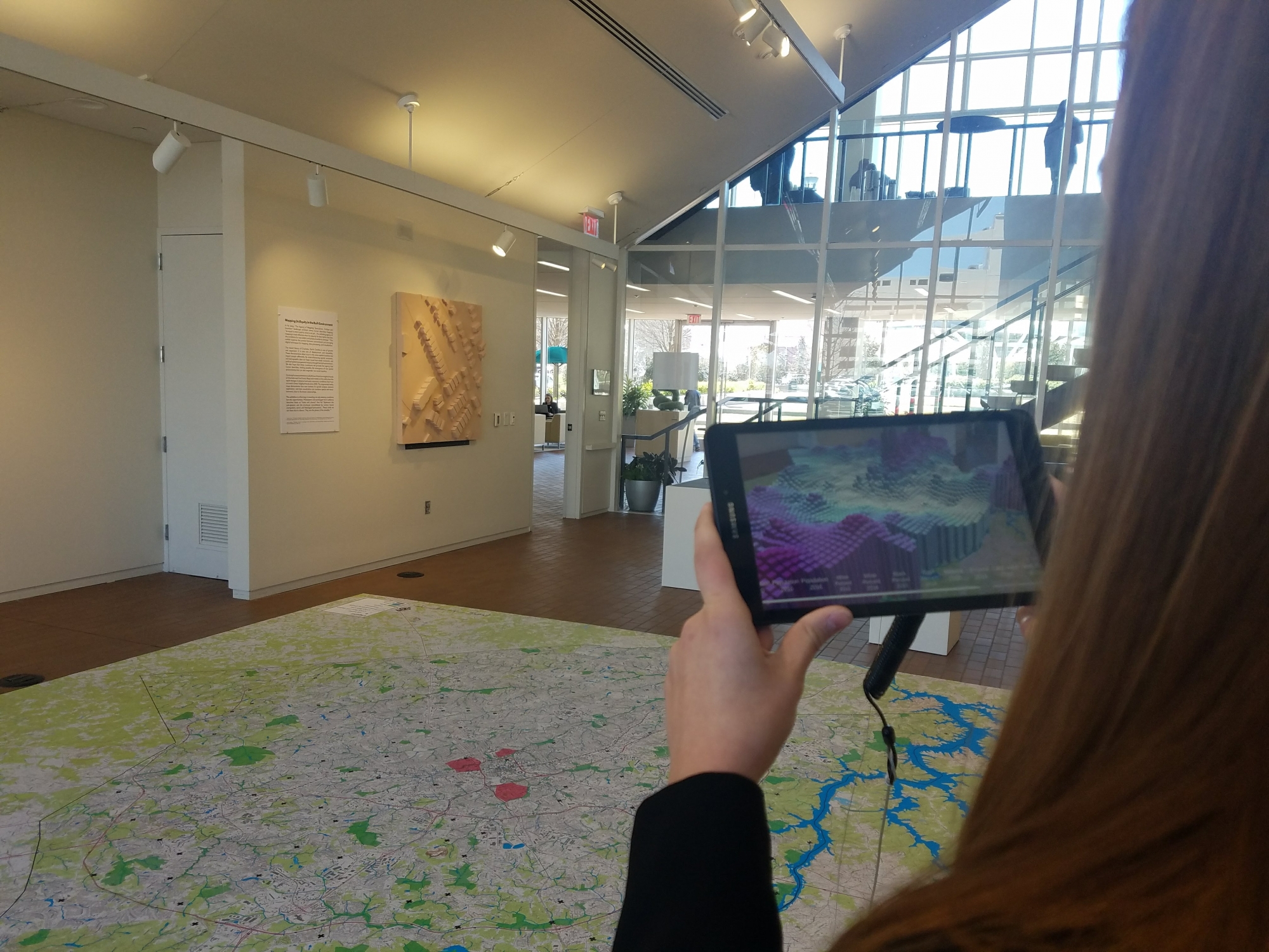
Lee’s project, "Transforming City of Charlotte with Immersive Visual Data", is one of seven recipients of $1 million in funding from the John S. and James L. Knight Foundation to foster civic engagement through access to public data. During the course of the project, an immersive platform that provides 3D visualizations of future developments in Charlotte neighborhoods will be developed.
Read more →
Ming-Chun Lee has been named one of five inaugural fellows in the Niantic/Knight Fellows Program, a community engagement initiative by the John S. and James L. Knight Foundation and Niantic Inc., maker of the popular Pokémon GO game. The fellowship will support projects that address community issues and promote resident engagement using Niantic’s augmented reality technology.
Read more →
"Investments in digital engagement and smart city initiatives foster a more equitable Charlotte": A $1.2 million investment in several digital engagement initiatives is helping connect the people of Charlotte and build a more inclusive community. In an increasingly connected world, technology can serve as an effective tool to strengthen civic engagement. The John S. and James L. Knight Foundation has committed more than $1.2 million in digital inclusion, immersive technology and smart city projects in Charlotte that put people at the center of the decision-making process for community development.
Read more →